24.9 C
Monrovia
Thursday, October 31, 2024
Home Tags Sustainable Development Institute

Tag: Sustainable Development Institute

Group Formed to Tackle Land Conflicts

0

Top: Some members of the network’s leaders at the Second National Land Conference last month in Ganta, Nimba County. The DayLight/ Harry Browne


By Esau J. Farr  


GANTA, Nimba County – Communities in rural Liberia seek a customary deed to their ancestral lands but are plagued by boundary disputes.

Now, a new group, the Southeast Regional Network of Community Land Development and Management Committees, has been established to help resolve border conflicts and enable communities to acquire deeds much faster.

“We will identify the concerns and claims of communities, [and] involve the elders and traditional people for a peaceful resolution…,” says Augustine Dweh, chairperson of the network. Dweh spoke to The DayLight at the sidelines of the Second National Land Conference in Ganta last month.

“We understand that land disputes scare away development and that’s why we want to be serious about resolving disputes in our communities for us to live in peace,” adds Dweh.

Dweh’s community, Chedepo District, River Gee, does not have any dispute with its neighbors. However, several southeastern communities do. For instance, Lower Bokon, a clan in Sinoe’s Jaedae District, has had its quest for a deed stalled due to an issue with Neekleakpo, a town on the Grand Kru border.

Established this year, the network has more than 70 communities seeking a customary deed, according to the Sustainable Development Institute (SDI), the Margibi-based NGO that helped form it.

The Land Rights Act of 2018 gives communities ownership of customary land, but their ownership must be formalized by meeting certain requirements.

The process begins with locals self-identifying as a landowning community.  They are required to create a bylaw and constitution, organize a governance body and cut boundaries with their neighbors. Then the Liberia Land Authority should conduct an official survey and present that community a customary deed.

The network also seeks to build its members’ capacity and increase awareness of land rights and issues.

Communities in Liberia heavily depend on over a dozen NGOs and development institutions to guide them through legal requirements for customary land deeds.

To date, 30 communities have been issued deeds, according to the Land Authority. In addition, 21 statutory deeds have been issued, 50 communities have completed the survey process, and five are waiting for their deeds.

There is a growing call for the Land Authority to fast-track the process, while NGOs criticize the regulator for prioritizing certain communities. The Land Authority blames the delay on poor funding and the lack of coordination with NGOs.

SDI helped form the network with funding from the US-based Rights and Resources Institute (RRI). The network intends to use peaceful traditional means to resolve existing and future boundary conflicts without the direct involvement of NGOs.
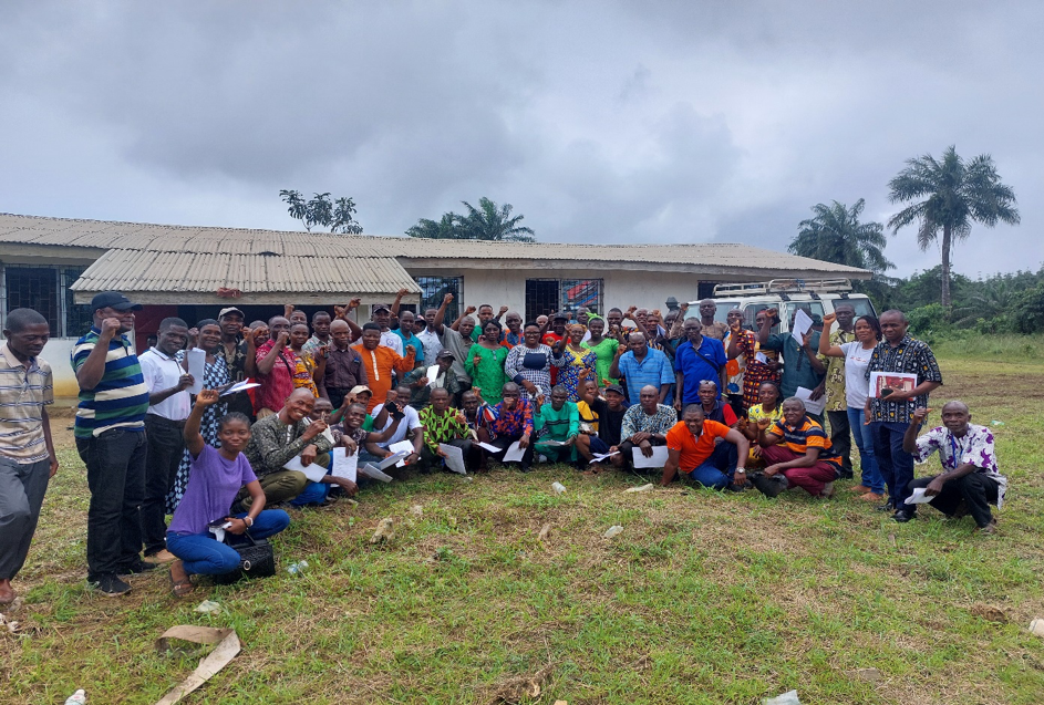
Members of the SRNCLDMC and SDI’s staff. Photo credit: Sustainable Development Institute (SDI)

“Due to the absence of a regional and national body of the land sector, issues and challenges from the communities are difficult to handle or address,” says Daniel Wehyee, the coordinator of SDI’s community land protection program.

“The coming together of the communities will provide [them] opportunities to mobilize resources and strengthen its operations,” adds Wehyee. He says the establishment of the network presents an opportunity for community land rights actors to come together and champion their cause.

Last month, members of the network elected Dweh as chair, Mamie Freeman of Sinoe co-chair, and Jacob Nyamah of Maryland secretary general. Relevance Zeon of Grand Gedeh took the financial secretary position, while Tetoe Davis of River Cess and Anabel Sewon of Grand Kru clinched treasurer and chaplain, respectively.

The network seeks funding from national and international partners for the empowerment of its members at all levels. Lack of logistical support and funding to empower CLDMCs across the country delays customary land formalization processes.

“If we have bikes to visit our regional communities,” Dweh says, “it will help us settle boundary disputes to fast-track customary land formalization process.” 

Government completes Surveys for Four River Cess Clans

0

Top: An elevated view of a portion of Teekpeh Clan’s 65,224.61 hectares of land. The DayLight/Derick Snyder


By Harry N. Browne


TEEKPEH – Liberia Land Authority has conducted surveys in four clans in River Cess County, the last stage for the communities to get customary land deeds.

The Land Authority conducted the surveys recently for Teekpeh, Ziadue, Dorbor and Gbarsaw, bringing to an end four years of quest for their ancestral land rights.

“I feel so glad because, for the time Liberia existed, we were [squatters]. For us to be the legitimate owners of our land, we really appreciate that,” said Fredrick James, the chairman of Teekpeh’s Community Land Development and Management Committee.  

“If you do not have a deed for [your land] in Liberia, then … the land is not for you,” said Blessing Nagba, Town Chief of Zammie Town, one of Teekpeh’s largest communities.

Before the official survey, Teekpeh, Ziadue, Dorbor and Gbarsaw declared their intention to get title deeds for their lands. Later, they formed land governing bodies and conducted open mapping of their areas, requirements in the Land Rights Act of 2018 for a customary land deed.

The confirmatory surveys were conducted in a peaceful and orderly manner with all of the parties represented. Representatives of the four clans, the Liberia Land Authority, and civil society gathered at the various boundary points to witness the process.

Blessing Nagba, Town Chief of Zammie Town in Teekpeh Clan

Before that, the surveyors asked the representatives to walk them to the actual spot that all parties agreed to. Then they took points from each location and planted trees at those points.  There are 39 border points among the four clans.

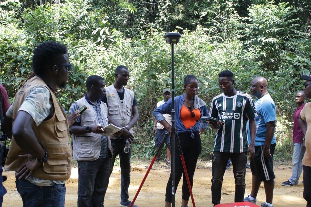
Representatives for the clans posed for a picture at each boundary point for evidence, using special equipment that processes and stores data on a memory card and to a satellite. The pictures will remain there as long as the satellite is in space.

Surveyors of the Land Authority survey Teekpeh and Ziadue in River Cess. The DayLight/Harry Browne

The advanced GPS equipment works directly with the satellite for accuracy. It had been recommended as part of a US$3.45 million project to assist communities get their customary deeds, funded by the International Land and Forest Tenure Facility of Sweden.

Before the survey, the Land Authority conducted a two-day workshop on how the instrument works for transparency’s sake.  

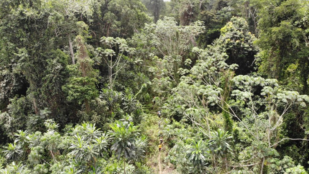
The survey had lots of challenges. The teams traveled hours between clans to cut boundaries in hard-to-reach areas. The Thick, green forest features creeks, valleys, mountains, and wildlife. Townspeople, who knew the route well, helped carry the equipment on their heads under the forest’s shade.

The survey team walked for hours in the forest to confirm the land areas of Teekpeh, Ziadue Gbarsaw and Dorbor Clans in River Cess County. The DayLight/Derick Snyder

I am here for land, for us to cut our land boundary between, Ziadue and Teekpeh. [This] is the reason we came in the bush,” said Rebecca Miller, town chief of Zeegar Town in Teekpeh.

The four clans cover a combined 152,937.57 hectares of land. Of that total, Teekpeh is the largest with 65,224.61 hectares, followed by Dorbor with 34,276.06 hectares, Ziadue with 32,718.45 hectares and Gbarsaw with 20,000 hectares.

‘Give and take’

But the clans’ success did not come without challenges. They had to resolve several land crises.  

Ziadue and Teekpeh fought for Yarvoe, a village that has a potential for gold, according to a survey by the Ministry of Mines and Energy. Teekpeh claimed the Yarvoe because it holds the clan’s ancestral graveyard. Ziadue’s contention was it (a 45-minute walk) is closer to the village than Teekpeh  ( a two-hour-45-minute walk).  In the end Teekpeh prevailed following six years of heightening tension.

“All we needed to do was to convince them that land business is give and take,” recalled James. “That was the only way we were able to convince our people and the exercise went on.”

Ziadue and Teekpeh also squared off with Dorbor over a place named Sand Beach Junction for two years.  Once more the three clans agreed to turn over the land to Teekpeh following two years of standoff.

Dorbor had another conflict with Gbarsaw over a parcel of farmland across a creek. Dorbor surrendered the land to Gbarsaw

“We protected the communities until we went to all those boundaries. We did give-and-take,” said Tito Davis, the chairman of the Dobor Community Land Development Committee. We felt that we wanted deed so, Dorbor gave most of the land out.”

At times, the Land Authority and civil society were caught up in the conflicts.

Arthur Cassell, the geographic information system (GIS) specialist with the Sustainable Development Institute (SDI), which works with the communities, experienced some of them. In one incident, townsmen, unhappy with a borderline they had drawn, chased Cassell and his team into a bush.

“You know the small creek in the bush have their names and sometimes through oral history. Somebody might miss the name or somebody might miss the location of the creek. That was the hold situation,” Cassell said.

“To see the four of them Ziadue Teekpeh, Dorbor and Gbarsaw get their confirmatory survey in one go, it is a plus for us,” Cassell added.

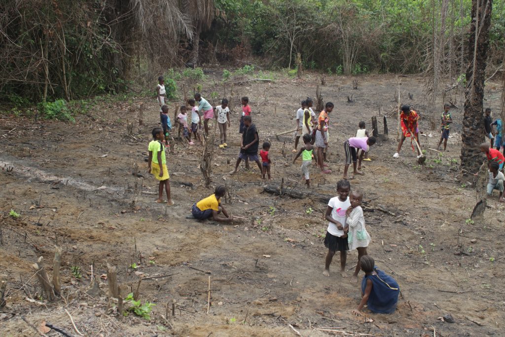
Children work on a farmland in Dorbor Clan, River Cess County. The DayLight/Harry Browne

The Land Authority is expected to grant the four clans their customary deed soon. They make it 11 communities in River Cess and 20 across the country whose lands have been surveyed. Eight communities have already been granted customary deeds, with Fessibu in Lofa the latest.

We are quite assured that in the next few weeks or so their deeds will be prepared,” said Jerome Vanjah Kollie, the National Coordinator for Customary Boundary and Harmonization at the Land Authority. “We have concluded the work.”       

Bassa Clan Begins Final Stage to Get Land Deed

0
default

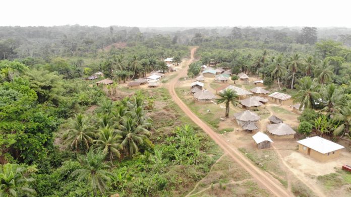
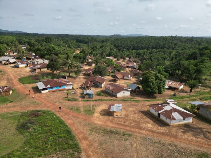
Top: A drone shot of Compound Number Two in Marblee Clan, Grand Bassa County. The DayLight/James Harding Giahyue


By Esau Farr


COMPOUND NUMBER TWO, Grand Bassa County – Between 2019 and last year, Marblee Clan completed most of the steps in legalizing its customary land ownership, failing to harmonize boundaries with its neighbors.

Now, it has an opportunity to solve that problem and receive a deed following the launch of a new project over the weekend. The “Keeping the Promise” project targets Marblee and 38 other communities across eight counties. Parley Liberia, a Bong County-based NGO, Sustainable Development Institute (SDI), and the Foundation for Community Initiatives (FCI) will assist the communities. The International Land and Forest Tenure Facility provided US$3.56 million for the three-year project.  

“We want you to get your land deed,” Dr. Raymond Samndong, Tenure Facility’s lead campaigner for Liberia, told a short ceremony in Compound Number Two, Grand Bassa County. “If you don’t have land, you don’t have an identity.”  

“Communities need their deeds and that is the focus of this project,” said Gregory Kitt of Parley Liberia, the NGO directing the project.

Marblee Clan stopped at the boundary harmonization stage over disputes with Karblee and Gogowein, its western and eastern neighbors, respectively. Its dispute with Karblee Clan is over an area covering 2, 057 hectares of land, while the disputed land with  Gogowein spans 264 hectares.  

Under the Land Rights Act, communities must cut their boundaries with their neighbors. After that, the law requires the Liberia Land Authority (LLA) to conduct an official survey to grant their deeds.   

Alexander Cole, FCI’s land rights campaigner, told The DayLight the NGO was talking to the Liberia Land Authority to assist in resolving Marblee’s land disputes. Cole said they would train members of the clan’s governance body known as the community land development and management committee (CLDMC).

Bendu Darsure, a women representative of the community stated that “The coming of the project into our community has made some of us know our rights to properties, especially land.”

Report Accuses MOPP of Land Grab, Pollution and Labor Abuses

0
created by dji camera

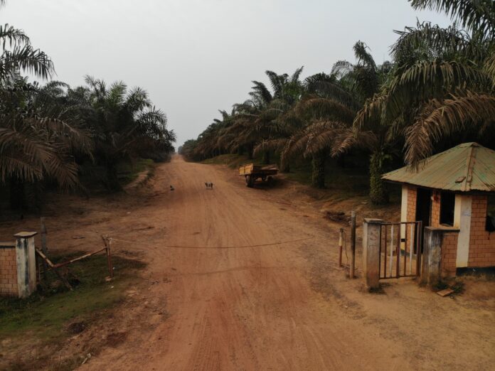
Top: The entrance of the headquarters of Maryland Oil Palm Plantation (MOPP) in Pleebo Sodoken District. The DayLight/James Harding Giahyue


By Mark B. Newa


MONROVIA – The Maryland Oil Palm Plantation (MOPP) is involved in bad labor practices, land-grabbing and pollution, a new report by the nongovernmental organization the Sustainable Development Institute (SDI) alleges. It accuses MOPP of wiping out local communities’ livelihood in violation of Liberian laws.  

The “Social and Environmental Impacts of Maryland Oil Palm Plantation in Liberia” report alleges the company of abusing the rights of locals to their land, and pushing them into poverty by polluting water sources and reneging on its concession obligations to develop their farms or smallholders program.  

“Today, we bring you compelling revelations… an open disregard of the rights and dignity of local communities affected by MOPP,” James Otto, a lead campaigner at SDI, told a press conference marking the launch of the report.  

“The SDI has worked to bring… issues impacting communities and environment, blatant violations of our laws and lack of respect for local communities on whose land whose land and resources company operates in our country,” Otto added.

SDI said it interviewed 23 people placed in 10 groups from seven communities for the report. It also interviewed the head of the local office of the EPA and local authorities, and photographs relevant places with global positioning system (GPS) coordinates.

MOPP did not answer queries for comments.

MOPP signed its concession agreement with the Liberian government in 2011 for covering 15,200 hectares of land in Maryland County and Grand Kru and worth US$230 million over the 25-year period. Owned by the Ivorian SIFCA Group, MOPP took over the ruins of Decoris Oil Palm Company, also based in the Ivory Coast after the end of the Liberia civil wars.  

Following in Decoris’ footsteps, MOPP with the aid of armed police, cleared communities’ lands, destroyed their ancestral graveyards dishonored traditional shrines and sacred sites, leading to riots.

Land-grab

MOPP abused communities’ rights to their ancestral land, the report says. The company did not get the consent of of local communities—including some that legally documents—before developing its plantation. It accuses the company of illegally including 6,400 acres of land on which it is obligated to develop farms for villagers, and that the company has no individual agreements with communities.  

Findings of the report are similar to a 2015 report by the Social Entrepreneur for Sustainable Development (SESDev) and Forest Peoples Programme.   

“Communities have the right to a formal and legally binding agreement with the company on the use of their lands,” Otto said. “MOPP urgently needs to start negotiating and listening to communities agree on terms and conditions of a lease, provide loss and damages and give back land to communities where requested.”

“If the employee or contractor is sick or even if he/she is hurt at work it will be noted as an ‘absence’ and the day salary is not paid – or employees receive only half of their due payment,” according to the report.

Criminalization

Citing unnamed sources, the report alleges that MOPP harasses and intimated citizens.

One woman said MOPP security guards arrested and beat her daughter who they accused of stealing palm nuts. The woman said “I had to pay L$3,000 to the MOPP security to free her.” Her comments are backed by a civil society actor.  

The report narrates an account of a local named Saturday Wilson, who it says has been frequently intimidated by MOPP for over a decade for a farmland in Gewloken, the town closest to MOPP’s headquarters.

“I am being threatened again and again repeatedly for the small piece of land owned by my family on which I planted palm. MOPP still wants to use the LLA agents and the court to take it away from me. As I speak, they are still after me.

Labor Issues

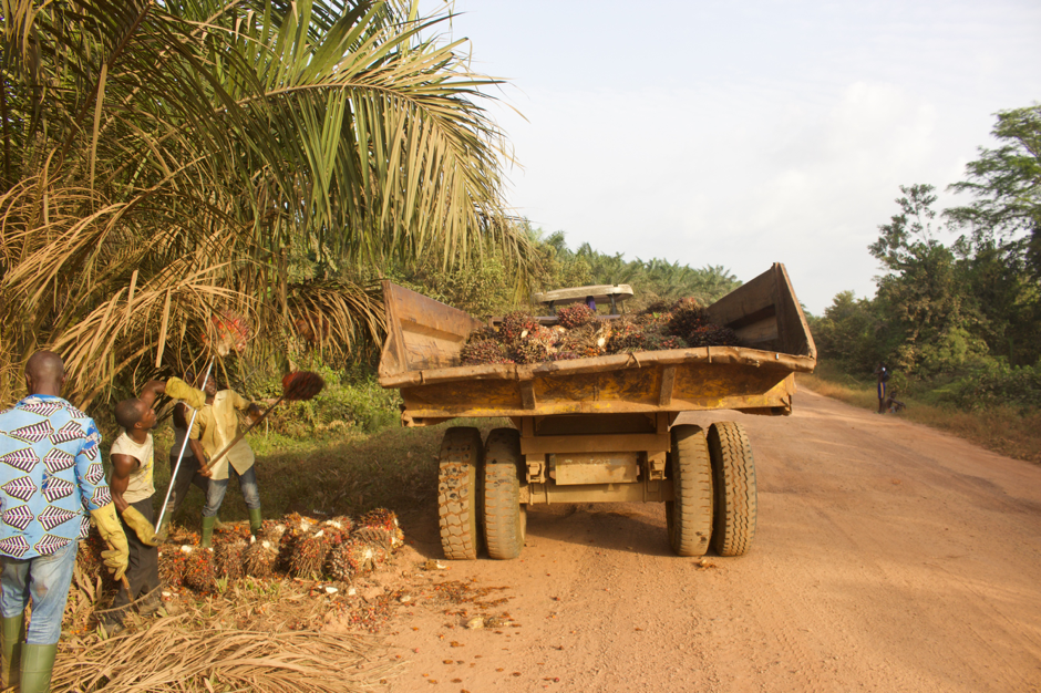
MOPP pays it contractors below the minimum wage (US$5.50 per day), cutting some contractors’ wages when they are sick or injured, the report alleges. The company does not permanently employ contractors even after three years.

“Contractors receive no payment for the day if production goals are not met. Production goals include the number of palms cleared of weeds as well as harvest volumes,” it says.   

A new report by the Sustainable Development Institute (SDI) accuses Maryland Oil Palm Plantation (MOPP) of bad labor practices. The DayLight/James Harding Giahyue.

Pollution

The report accuses MOPP of planting in swamps, a breach of its environmental and social impact assessment (ESIA), the Environmental Protection and Management Law of Liberia, and principle of the Roundtable on Sustainable Palm Oil, the global watchdog for the commodity industry.  

MOPP’s mill waste and fertilizers are seeping into creeks used by locals for drinking water, it says, citing several locals.

“They planted palms in all the swamps around here. And when the palm started growing, they used to apply fertilizers and it really used to affect our water,” one says.  

And another, “They are still dumping the palm butter in the Swanpken river and people downstream are finding it difficult to use the water now.”  

In 2017, the Environmental Protection Agency (EPA) fined MOPP US$10,000 for importing several chemicals into the country without acquiring the requisite approval from the agency.

Livelihoods

Communities told SDI researchers that their livelihoods have been heavily compromised due to pollution, forest degradation and a shortage of land, according to the report.  

As the result, farmers have no access to herbs and firewood, forest to hunt, and waterfronts to fish, it says, adding grass the company had planted to control weeds are destroying their crops.  

“Reduced access to farmland increases food insecurity and less cash crops to support family incomes. Villages literally find the oil palms on their doorsteps. They have no living space or only degraded or poor areas where they can try and provide for their families,” the report added.

“The little farmland that we secured is no longer good because we have used it over and over again,” one farmer says in the report.

The report calls on MOPP to halt its expansion until it signs memoranda of understanding with communities, pays compensation for land-grab, completes the development of the mandatory smallholders’ program.

MOPP did not reply a set of questions from The DayLight on the issues raised in the report. The company did not respond to follow-up emails.

Podcasts