29.3 C
Monrovia
Saturday, January 25, 2025
Home Tags Ancestral land rights

Tag: Ancestral land rights

‘I am Happy’: Widow Celebrates Community Land Rights

0

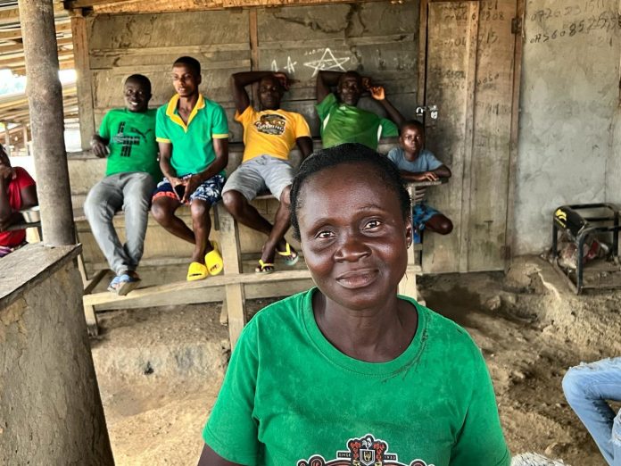
Top: Theresa Wleh, Chairlady of the Diyenkpo community sitting with a smile and children in the back. The Daylight/Matenneh Keita


By Emmanuel Sherman


DIYENKPO, Sinoe County – Theresa Wleh lives with her four children in the home of her late husband. Not just that house, Wleh farms on the plot of her late husband’s farmland, and she is fully recognized by her in-laws.

“I am happy,” Wleh tells The DayLight in an interview in Diyenkpo, a Sinoe town on the border with Grand Kru. It is the headquarters of the Lower Bokon Clan located in the Jaedae District.

“The reason that I am happy is since [my husband died], I am still sitting down here. When you want to move me, my kids are here,” Wleh adds.  

Wleh knows that things have not always been that way. Under a decade ago, women had no right to own community land or participate in ancestral land matters.  Generations of ill-fated customs and traditions discriminated against womenfolk, often leaving them to their male relatives’ mercy. On the other hand, powerful chiefs and elders, who were the custodians of lands, decided on matters without women’s consent.

All that changed in 2018 when Liberia created the Land Rights Act, which granted women customary land ownership. The new law also mandates women’s participation in community land governance.  

“I am happy for the government of Liberia to give women the right to own their land and have their deed. The land deed is important to us mothers and our children because when we leave tomorrow…, it is for your child or children,” Wleh says.

‘I used to feel bad’

Together with women’s landownership, the new law recognizes community land rights, based on local customs and folkways. It is the main highlight of the law, turning around decades of marginalization of rural people.  

While communities own ancestral lands by law, they should go through legal requirements to get a deed. Lower Bokon is at the boundary-harmonization stage of those requirements, having identified as a landowning clan, created a land body and mapped its assumed 7,283-hectare landmass. Several communities have obtained customary deeds, including Zolowee, Gbassa and Zor-Yolowee in Nimba.

But Lower Bokon has to resolve a boundary dispute with Neeklakpo, a town in Grand Kru, for the Land Authority to present its deed.
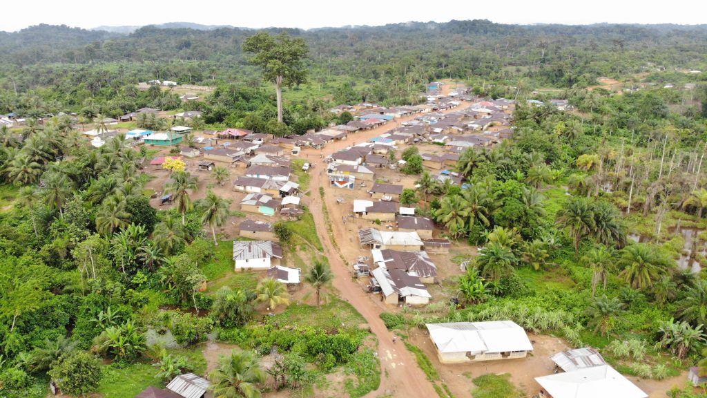
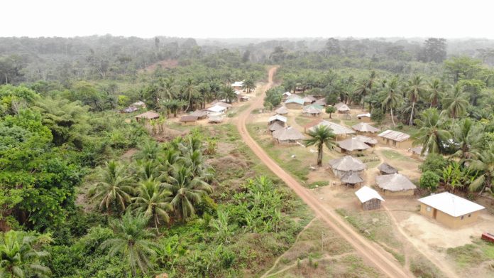
An elevated view of the Lower Bokon Clan, which covers an assumed 7,283 hectares of land in Sinoe’s Jaedae District. The DayLight/Derick Snyder

The Land Authority is working with other government agencies to resolve the dispute, according to Dr. Mahmoud Solomon, the Acting Commissioner for Land Administration. Solomon said the regulator was comparing data from those agencies, including the National Legislature, to determine the border points.

“We will soon resume to have it resolved amicably,” Solomon says in an interview at his Ashmun Street office. Bokon is one of the dozens of communities whose lands the Land Authority is formalizing as part of a US$3.45 million project funded by the International Land and Forest Tenure Facility in Sweden.

Wleh cannot wait for the disagreement to be solved. She wants to witness the resolution as it is in the interest of the community. But she does not allow the impasse to spoil her party.

“I am happy for us to reach this level. During our forefathers’ time, they were blind to the system. I used to feel bad when people came to use the land. At the time we never knew anything,” Wleh recalls. “Whatever they wanted to do was what they would do here.

“If we have our land deed, it will be good for us. Nobody will come and say, ‘This place is mine.’ As long as I have my deed and you are coming on my land, there will be an agreement between us,” she says.   

Wleh might be a bit cocky but her comments are not unfounded.

Lower Bokon is situated in a mining region, with little or no benefits to affected communities. Hummingbird, a British company, has operated there since 2019, according to official records. The records show that the Ministry of Mines and Energy has awarded 127 licenses in the region since 2013, predominantly for small-scale mining. Of that number 17 are active licenses.
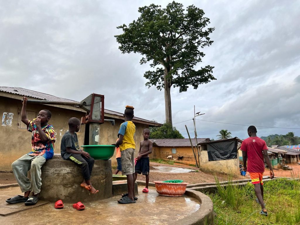
Children fetch water at a hand pump in Diyenkpo, the headquarters of the Lower Bokon Clan in Jaedae District, Sinoe County. The Daylight/ Matenneh Keita

Despite these activities, the clan lacks a lot of necessities for its estimated 5,000 people. It lacks clinics, paved roads, and adequate water sources. Wleh and other Diyenkpo residents go to Karquekpo, the largest town in the region, for medication. The miners do not pay the clan anything.

The Land Rights Act empowers communities to buck that trend. With a deed, locals can enter into agreements with companies as parties to the investment, not just affected communities. They have the right to consent to or reject investment proposals.

“The kids we are having now, we want them to go to school so, that tomorrow we will benefit from them,” Wleh says. “When you come into our community and we tell you this is what we want and you cannot deliver, pack up your bag and leave.”  

Government completes Surveys of Four River Cess Clans

0

Top: An elevated view of a portion of Teekpeh Clan’s 65,224.61 hectares of land. The DayLight/Derick Snyder


By Harry N. Browne


TEEKPEH – Liberia Land Authority has conducted surveys in four clans in River Cess County, the last stage for the communities to get customary land deeds.

The Land Authority conducted the surveys recently for Teekpeh, Ziadue, Dorbor and Gbarsaw, bringing to an end four years of quest for their ancestral land rights.

“I feel so glad because, for the time Liberia existed, we were [squatters]. For us to be the legitimate owners of our land, we really appreciate that,” said Fredrick James, the chairman of Teekpeh’s Community Land Development and Management Committee.  

“If you do not have a deed for [your land] in Liberia, then … the land is not for you,” said Blessing Nagba, Town Chief of Zammie Town, one of Teekpeh’s largest communities.

Before the official survey, Teekpeh, Ziadue, Dorbor and Gbarsaw declared their intention to get title deeds for their lands. Later, they formed land governing bodies and conducted open mapping of their areas, requirements in the Land Rights Act of 2018 for a customary land deed.

The confirmatory surveys were conducted in a peaceful and orderly manner with all of the parties represented. Representatives of the four clans, the Liberia Land Authority, and civil society gathered at the various boundary points to witness the process.

Blessing Nagba, Town Chief of Zammie Town in Teekpeh Clan

Before that, the surveyors asked the representatives to walk them to the actual spot that all parties agreed to. Then they took points from each location and planted trees at those points.  There are 39 border points among the four clans.

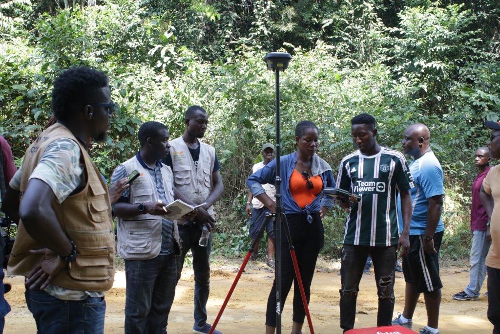
Representatives for the clans posed for a picture at each boundary point for evidence, using special equipment that processes and stores data on a memory card and to a satellite. The pictures will remain there as long as the satellite is in space.

Surveyors of the Land Authority survey Teekpeh and Ziadue in River Cess. The DayLight/Harry Browne

The advanced GPS equipment works directly with the satellite for accuracy. It had been recommended as part of a US$3.45 million project to assist communities get their customary deeds, funded by the International Land and Forest Tenure Facility of Sweden.

Before the survey, the Land Authority conducted a two-day workshop on how the instrument works for transparency’s sake.  

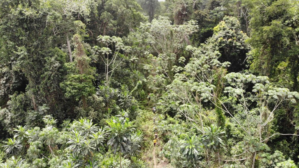
The survey had lots of challenges. The teams traveled hours between clans to cut boundaries in hard-to-reach areas. The Thick, green forest features creeks, valleys, mountains, and wildlife. Townspeople, who knew the route well, helped carry the equipment on their heads under the forest’s shade.

The survey team walked for hours in the forest to confirm the land areas of Teekpeh, Ziadue Gbarsaw and Dorbor Clans in River Cess County. The DayLight/Derick Snyder

I am here for land, for us to cut our land boundary between, Ziadue and Teekpeh. [This] is the reason we came in the bush,” said Rebecca Miller, town chief of Zeegar Town in Teekpeh.

The four clans cover a combined 152,937.57 hectares of land. Of that total, Teekpeh is the largest with 65,224.61 hectares, followed by Dorbor with 34,276.06 hectares, Ziadue with 32,718.45 hectares and Gbarsaw with 20,000 hectares.

‘Give and take’

But the clans’ success did not come without challenges. They had to resolve several land crises.  

Ziadue and Teekpeh fought for Yarvoe, a village that has a potential for gold, according to a survey by the Ministry of Mines and Energy. Teekpeh claimed the Yarvoe because it holds the clan’s ancestral graveyard. Ziadue’s contention was it (a 45-minute walk) is closer to the village than Teekpeh  ( a two-hour-45-minute walk).  In the end Teekpeh prevailed following six years of heightening tension.

“All we needed to do was to convince them that land business is give and take,” recalled James. “That was the only way we were able to convince our people and the exercise went on.”

Ziadue and Teekpeh also squared off with Dorbor over a place named Sand Beach Junction for two years.  Once more the three clans agreed to turn over the land to Teekpeh following two years of standoff.

Dorbor had another conflict with Gbarsaw over a parcel of farmland across a creek. Dorbor surrendered the land to Gbarsaw

“We protected the communities until we went to all those boundaries. We did give-and-take,” said Tito Davis, the chairman of the Dobor Community Land Development Committee. We felt that we wanted deed so, Dorbor gave most of the land out.”

At times, the Land Authority and civil society were caught up in the conflicts.

Arthur Cassell, the geographic information system (GIS) specialist with the Sustainable Development Institute (SDI), which works with the communities, experienced some of them. In one incident, townsmen, unhappy with a borderline they had drawn, chased Cassell and his team into a bush.

“You know the small creek in the bush have their names and sometimes through oral history. Somebody might miss the name or somebody might miss the location of the creek. That was the hold situation,” Cassell said.

“To see the four of them Ziadue Teekpeh, Dorbor and Gbarsaw get their confirmatory survey in one go, it is a plus for us,” Cassell added.

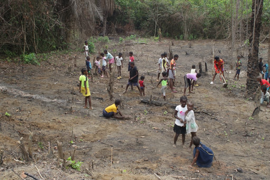
Children work on a farmland in Dorbor Clan, River Cess County. The DayLight/Harry Browne

The Land Authority is expected to grant the four clans their customary deed soon. They make it 11 communities in River Cess and 20 across the country whose lands have been surveyed. Eight communities have already been granted customary deeds, with Fessibu in Lofa the latest.

We are quite assured that in the next few weeks or so their deeds will be prepared,” said Jerome Vanjah Kollie, the National Coordinator for Customary Boundary and Harmonization at the Land Authority. “We have concluded the work.”       

Bassa Clan Begins Final Stage to Get Land Deed

0
default

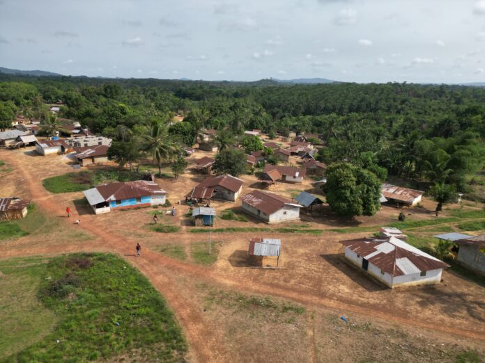
Top: A drone shot of Compound Number Two in Marblee Clan, Grand Bassa County. The DayLight/James Harding Giahyue


By Esau Farr


COMPOUND NUMBER TWO, Grand Bassa County – Between 2019 and last year, Marblee Clan completed most of the steps in legalizing its customary land ownership, failing to harmonize boundaries with its neighbors.

Now, it has an opportunity to solve that problem and receive a deed following the launch of a new project over the weekend. The “Keeping the Promise” project targets Marblee and 38 other communities across eight counties. Parley Liberia, a Bong County-based NGO, Sustainable Development Institute (SDI), and the Foundation for Community Initiatives (FCI) will assist the communities. The International Land and Forest Tenure Facility provided US$3.56 million for the three-year project.  

“We want you to get your land deed,” Dr. Raymond Samndong, Tenure Facility’s lead campaigner for Liberia, told a short ceremony in Compound Number Two, Grand Bassa County. “If you don’t have land, you don’t have an identity.”  

“Communities need their deeds and that is the focus of this project,” said Gregory Kitt of Parley Liberia, the NGO directing the project.

Marblee Clan stopped at the boundary harmonization stage over disputes with Karblee and Gogowein, its western and eastern neighbors, respectively. Its dispute with Karblee Clan is over an area covering 2, 057 hectares of land, while the disputed land with  Gogowein spans 264 hectares.  

Under the Land Rights Act, communities must cut their boundaries with their neighbors. After that, the law requires the Liberia Land Authority (LLA) to conduct an official survey to grant their deeds.   

Alexander Cole, FCI’s land rights campaigner, told The DayLight the NGO was talking to the Liberia Land Authority to assist in resolving Marblee’s land disputes. Cole said they would train members of the clan’s governance body known as the community land development and management committee (CLDMC).

Bendu Darsure, a women representative of the community stated that “The coming of the project into our community has made some of us know our rights to properties, especially land.”

Podcasts